The videos are up. If any of you would like a better quality DVD (with photos and extra video footage) of the whole thing, send me an email.
Archives for category: tours and trips
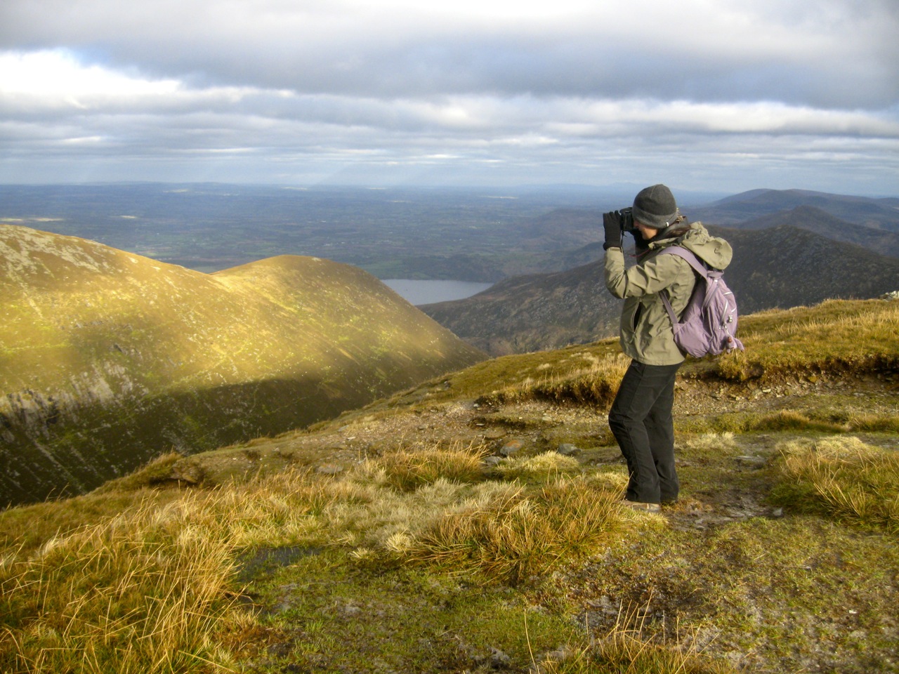
I took a trip to Purple Mountain in County Kerry this weekend. Purple Mountain is the highest in a small cluster of peaks directly across the lake from the town of Killarney.

We started our trip by the tourist centre at Kate Kearney’s cottage. From there we walked through the Gap of Dunloe, a spectacular narrow valley cutting through Ireland’s highest range of mountains. A low cloud accompanied us for the entire distance. It was magical.

As if on cue, the fog lifted just as we began our ascent. We spent an hour and a half climbing uphill beneath an unrelenting sun.

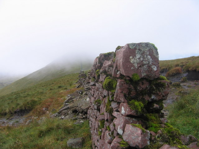
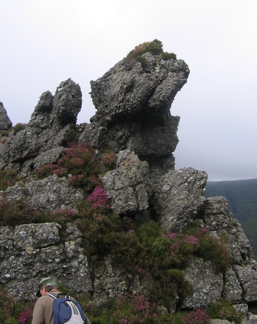
Dry blanket bog gave way to loose stone during the last few metres of the climb to the summit. The mountain is well-named: the old red sandstone gives the mountain a purplish hue from afar. While we were there, a helicopter flew through the Gap. You don’t see a helicopter flying beneath you every day.
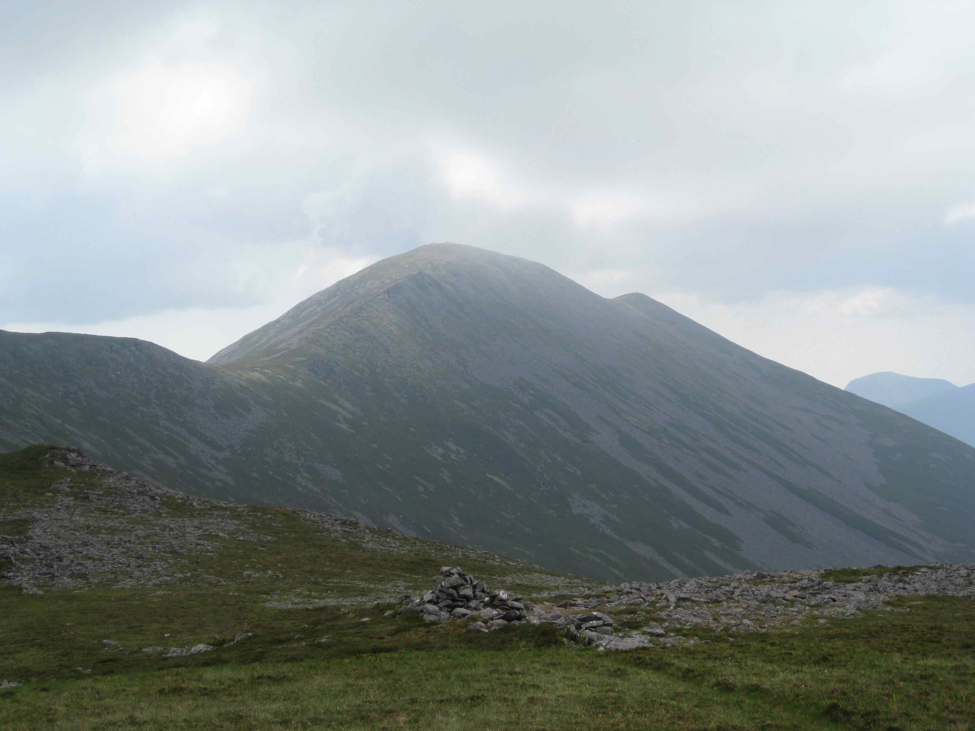
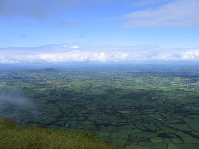
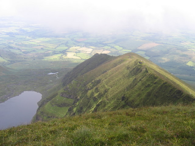
We proceeded on to Tomies mountain where we were rewarded with one of the most spectacular views in all of Ireland. To the West rose the Magillicuddy Reeks and Carrauntoohil. To the North, the Dingle Peninsula swept into the sea. To our East was Killarney, Lough Leane and the mountains beyond.
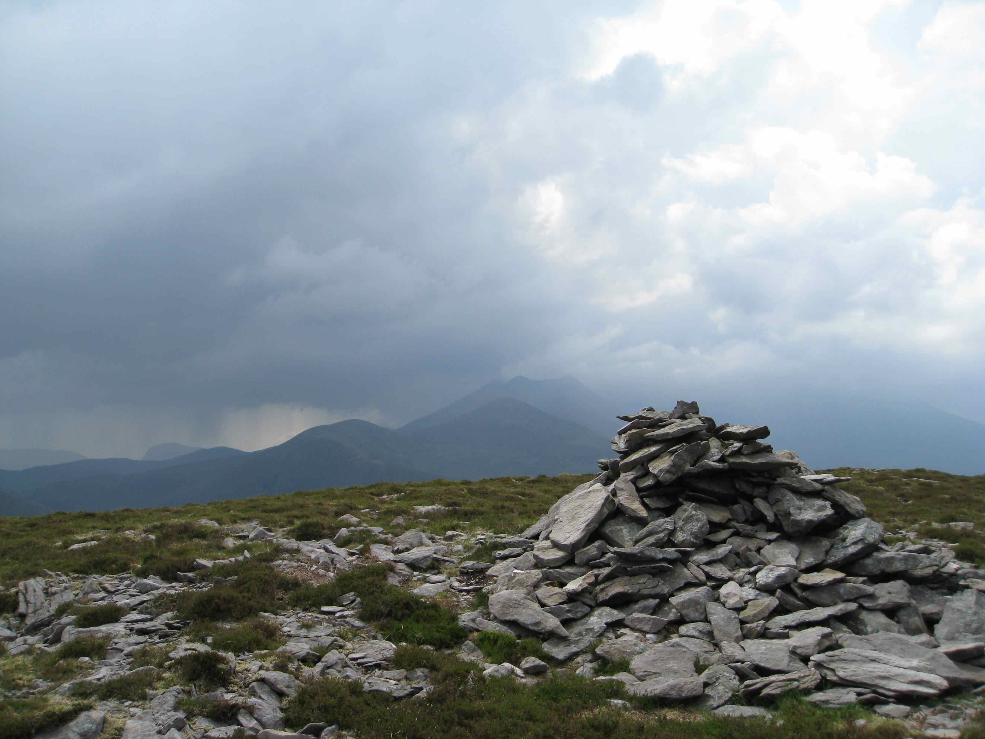
The sounds of thunder could be heard in the distance. Rain swept down in torrents near Mangerton. The rumbles began to get louder. It was time to go.

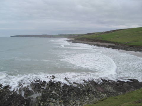
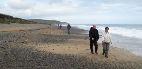
What a day.. not too hot, not too cold, a refreshing breeze, good company and delightful scenery throughout. This was the charity cliff walk from the small village of Ballycotton to the even smaller village of Ballinrostig in East Cork.

The walk stretched 20 km (13 mi) along beaches, over cliffs, through dense bushes and across fields with the walkers never too far from the coastal margin. Over 360 people attended today, raising money for the local Chernobyl charity.

I am very familiar with the local coastline, although my walks tend to be along the rocks, where I constantly have to be alert to changes in the tide.

It was a long walk. We started at 11.30 am and didn’t finish until after 4.30. Many people (the serious types) managed it in much less time. At the end of the walk, there were sandwiches and soup waiting for us. They tasted utterly delicious.
I was in Brittany a few weeks ago, attending the wedding of a good friend of mine. My elder kids and my mum came with me. Even though we only had a week before the kids went back to school, we managed to see a lot of the Breton countryside (as well as a few places in Normandy too).
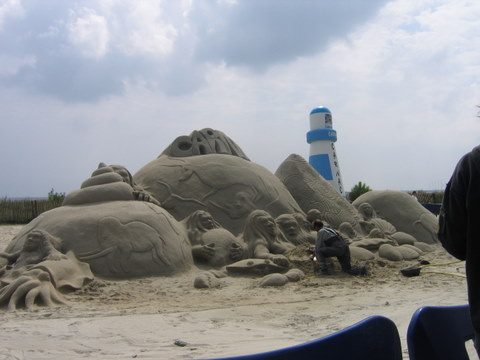
Carnac is one of the busiest beaches in Brittany – soft white sand, calm waters and one of the best ice-cream shops I have ever visited in my life. Oh, and they do sand sculptures too. Pah! Easy-peasy. Anyone could do it.

Carnac is famous for its 6,000 year old megaliths – granite pillars of varying size, aligned in rows and columns over a distance of almost 4 kilometres. Some people say it was a vast army turned into stone. Others claim it had a religious and astronomical purpose. I think myself it might have functioned as gigantic spreadsheet for Bronze Age accountants.

I found a number of imposing World War II fortifications in Gavres – a small village overlooking the city of Lorient. Lorient was a major U-boat base during the war. The city was practically razed to the ground during the first months of 1943.
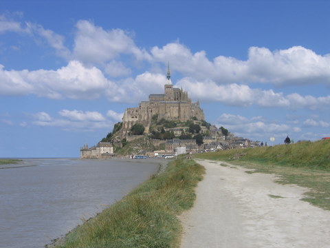
Le Mont St Michel, in the extensive mudflats of western Normandy, is one of the great “must see” places in Europe. Built on a granite outcrop and accessible via a long narrow causeway, the monastery dates back to the 8th Century with the main fortifications dating from the 15th century. It even served as a prison for a while after the French Revolution. More recently, Peter Jackson used it as his template for Minas Tirith in the Lord of the Rings. Yeah, yeah, it’s touristy and kitchy inside, but even so, it’s an impressive and inpirational place. The views take your breath away.

Here are my kids in a classic “James Bond” pose on a concrete defense in Utah Beah, the most northerly of the main landing beaches in Normandy. The invasion sequence in the film “Saving Private Ryan” was shot in Ireland, on Curracloe Beach in Wexford. The similarities between the beaches are incredible. Now quiet and placid, it is impossible to imagine what the beach would have looked like during the summer of 1944.
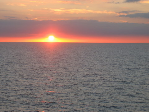
Finally, a sunset scene: taken from the ship on our way back home.
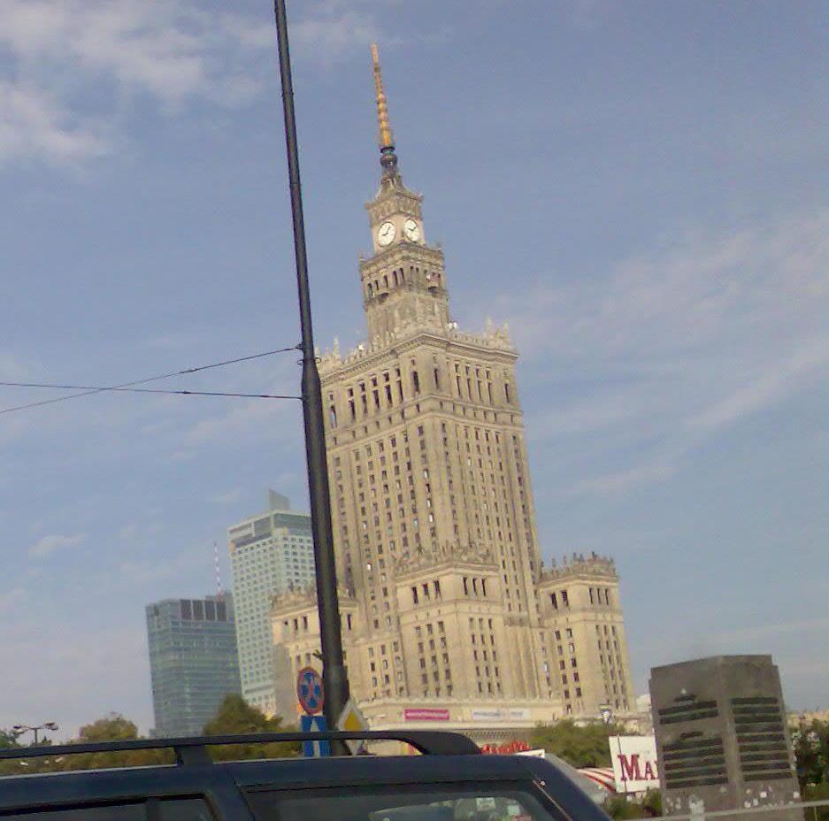
I took a short business trip to Warsaw earlier this week. It was my first time ever in Poland, and my brief impression of the place and its people was overwhelmingly positive. Up until this week, Poland was something of a mystery to me. Although there are lots of Polish people in Ireland at the moment, I know none of them, and thus I had no reference point.
It turns out that the Polish have a lot in common with us Irish. We are very similar in how we see the world. The Polish people I came in contact with were very friendly and seem to live in a world where people are continually putting up with less-than-stellar service and rules. If there’s a law, a regulation or a proscription, there’s a way around it. The Poles laugh a lot: always a good sign.
Compared to many countries in Western Europe, Poland still has some way to go. That doesn’t mean it won’t get there, however. There are clear similarities with the Ireland of 20 years ago. Back then, Ireland was still a backwater: a peripheral little fiefdom struggling to extract itself from decades of neglect, indebtedness and corruption. Few people could have imagined the social and infrastructural changes that would take place since then. The transition into a self-confident state, where things actually worked, was utterly unforeseen in the 1980’s. And yet, looking back, it now seems obvious that Ireland’s economic success was no accident and that many of the crucial factors were in place.
Well, that’s where I think Poland is now – on the cusp of a major economic and social revolution. It will take time: the current bunch of politicians there would make the Keystone Cops seem super-organised by comparison. The infrastructure is poor (Warsaw has only one metro line for a population of 3 million people), and inefficiency is the order of the day if the airport check-in procedures are anything to go by. But there appears to be a mood for change. The Polish who have left the country in recent years have a reputation for uncomplaining hard, high quality work. They love their country, and there’s a young population there who want their lives to be substantially different than what their parents settled for. In addition, the multinationals are entering Poland in their droves. You only need a few big names to enter to create momentum, and these names are now beginning to appear there, establishing substantial distribution and customer service operations.
My time there was short, but I’ve been given a flavour of the country, and I’d like to get back there again – to see more of Warsaw, the Baltic coast, Krakow, the Tatras Mountains and the Bielowieza Forest. Some day soon, perhaps.
I managed another trip to the Galtees last weekend. This time we took a different route, ascending the valley by Lyreacappul (Ladhar an Chapaill), traversing the ridge of Monabrack and descending into the valley by Sliabh Cois na Binne: a gigantic horseshoe route that took over 5 hours to complete. Apart from the occasional rain-shower, it was a magnificent day. The views from the top were incredible. The entirety of the southern half of Ireland is visible from the summit. What was missing was a view of the sea: the Galtees are Ireland’s only inland mountain range.
Click on the photos to enlarge


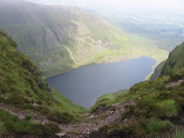
Last Sunday, I journeyed with a few like-minded souls to Coumshingaun in the Comeragh Mountains in Co. Waterford. The centrepiece is a corrie lake caused by glaciation during the last Ice Age. The corrie has a classic “armchair” shape: two gently ascending narrow ridges with precipitous drops on all three sides.

The journey upwards was quite difficult, compared to Galteemore. It’s a more challenging ascent due to the preponderance of rock outcrops and winding, up/down paths.
It took us about 2 hours to reach the top. Here’s a view of the ridge by which we ascended.
The “summit” is pretty flat, owing to the fact that the Comeraghs are about 350 million years old. Significant weathering, not to mention a few Ice Ages thrown in for good measure, have reduced the mountains to a uniform boggy plateau around 700 metres high.

Coumshingaun lake is impressive – a mile long, dark, mysterious, fed by gently gurgling waterfalls. Strewn around it are tons of piled up debris from ancient landslides.
We completed the “armchair” circuit in good time, returning to the car park in just over four hours. Just the antidote for those Monday morning blues!
Yesterday I went on a walk to Galteemore, the highest inland mountain in Ireland, just over 3,o00 ft high and the smallest of Ireland’s 14 munro’s.
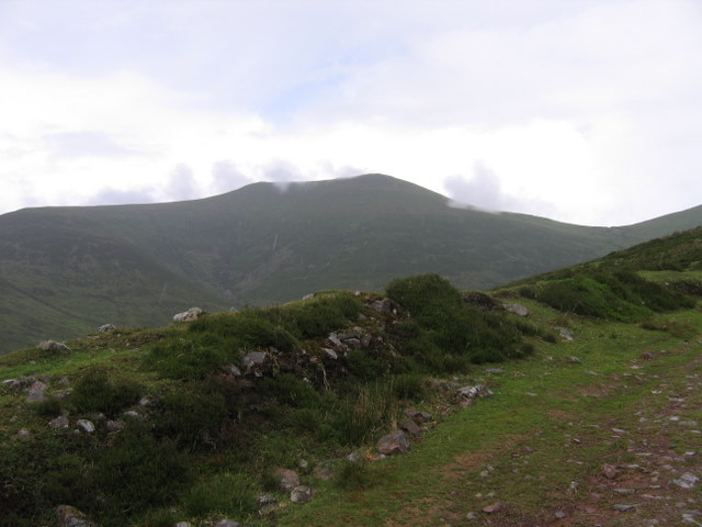
Galteemore is part of the Galtee range in South Tipperary. The mountains stretch about 20km in an East-West direction – roughly-speaking from Cahir to Mitchelstown. The main Dublin-Cork road skirts around its southern and eastern flanks. The Galtee’s are part of the same mountain building event that formed the extensive ridge-valley system of South west Ireland. North of the Galtees the sandstone ridges begin to disappear and the flatter terrain of the Irish Midlands begins.
I found the walk to the top quite easy, not to say picturesque. The col between Galteemore and it’s smaller sibling, Galteebeag, shows signs of ancient “bog bursts”, or landslides, where entire sections of peat seem to have fallen into the corrie lake below, exposing the solid rock base.

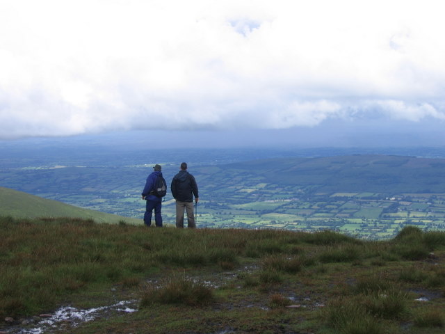
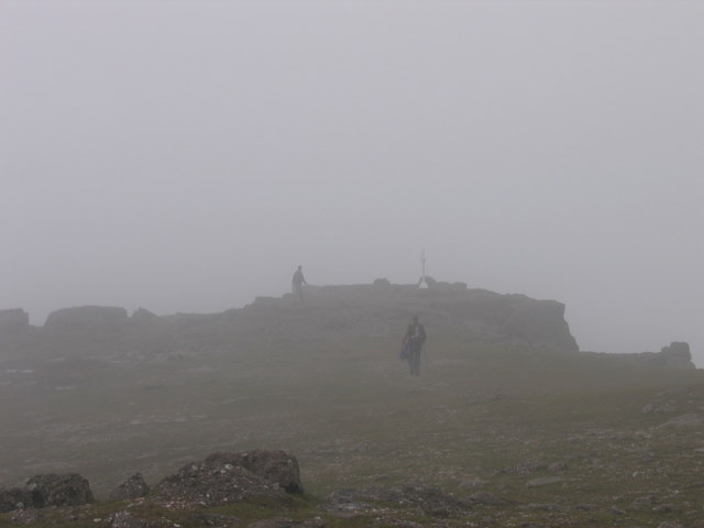
From the summit of Galteemore it is possible to see an amazing amount of southern Ireland: Waterford, Kilkenny, Cork, Tipperary, Limerick: possibly even Kerry, Clare and Carlow. Unfortunately I was unable to see anything at the summit as quite a dense fog closed in.
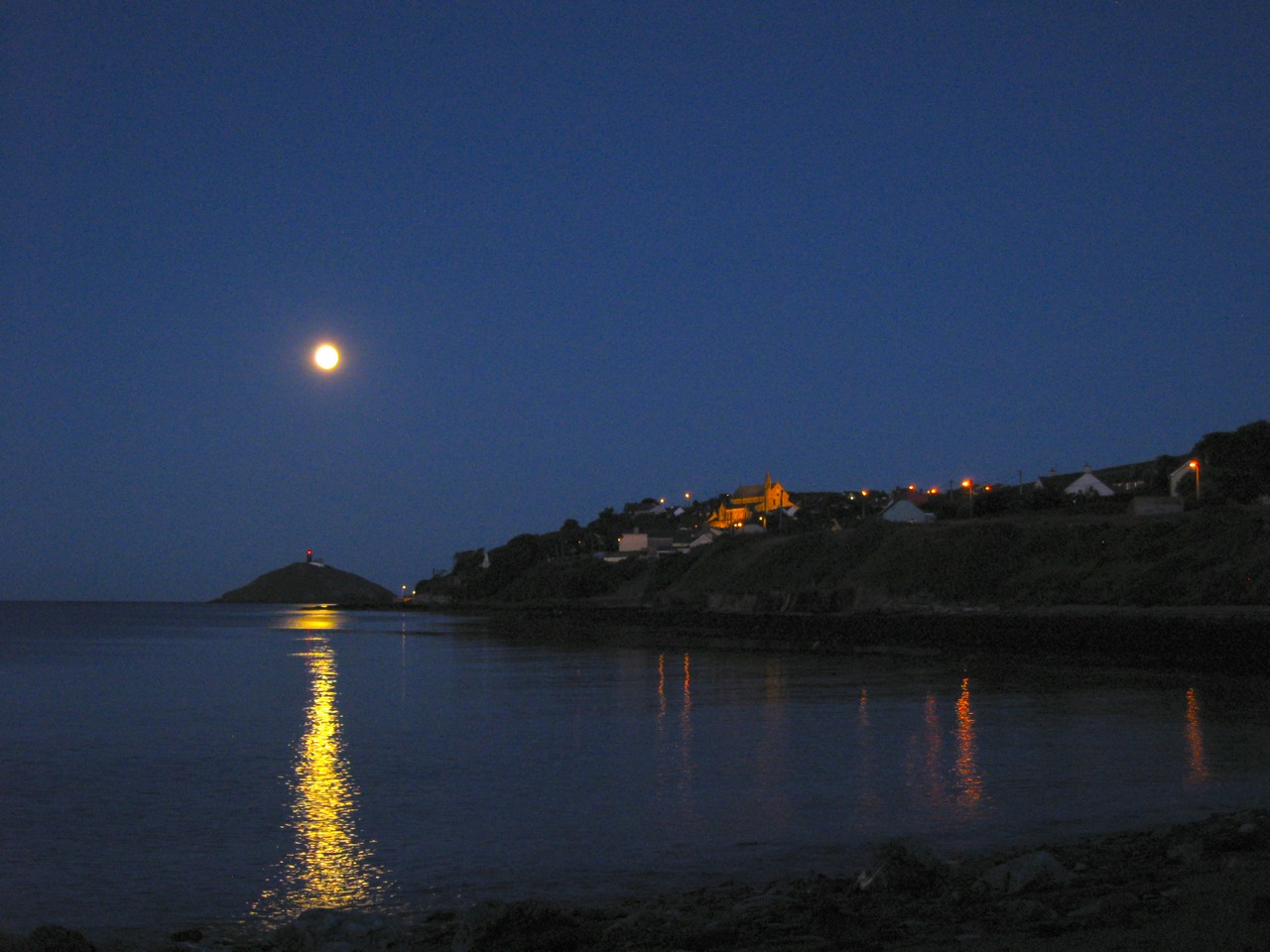
Yesterday we went down to Cobh to see a huge ocean liner arrive into the port.

The town of Cobh* has a fascinating maritime history. For decades, before the rise of air travel, it was the departure point for millions of Irish people as they set sail for the New World. It was the last port of call of the Titanic before its fateful crossing. It received the dead bodies from the Lusitania, when it was torpedoed off the Old Head of Kinsale. And it is a later addition to the Republic of Ireland, a “treaty port” ceded to the State by Britain just before the onset of World War II. The headquarters of the Irish Navy is just across a narrow channel from Cobh, on the island of Haulbowline.

The ship, the Navigator of the Seas, is one of the largest cruise ships in the world with a weight of 140,000 tonnes. It can carry over 3,000 passengers. In this case, the boat was on a short weekend trip from Southampton. The passengers must have been amazed when they were greeted by a large crowd of onlookers. It was a holiday weekend here, with a local festival happening in the town.

My kids were well impressed. A floating hotel of this magnitude is an impressive sight, no matter what age you are.

* Cobh is pronounced, and means, “Cove”: unusually, an “irishisation” of an English word. Most of our place names are anglicisations of Irish Words.
These ones are a bit different, but I thought I would share them with you anyway.

The Niagara Falls (Horseshoe Falls) from a slightly different perspective.
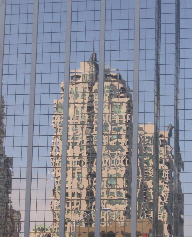
Reflections on a building in North York

Whirlpool, Niagara Gorge.

CN Tower from Centre Island
